Summary
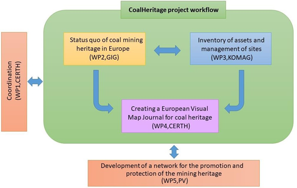
WP4 (purple colour in Fig. 1) aims to integrate the results of WP2 and WP3 in order to develop a geodatabase for coal heritage sites for the selected territories. The knowledge of coal post mining heritage on selected territories will be presented by including visual maps, informative texts and existing geospatial data. In addition, the results will be used to create the CoalHeritage European Visual Map Journal (EVMJ) that will feature interactive –storytelling maps, focusing on the coal mines heritage consisting of narrative texts, spatial content and multimedia presentations. The produced EVMJ will help local authorities and stakeholders to easily have access and navigate the database, which will be maintained during and after the end of the project for future use.
Objectives
The main objectives of WP4 are:
• To provide a better knowledge of coal post mining heritage on selected territories, including visual maps, informative texts and existing geospatial data in accordance to its historical evolution.
• To support the transfer of knowledge coal cultural legacy through a friendly-user environment representing and visualizing information to motivate a broad range of stakeholders in order to learn more and/or visit them.
• To keep updated the designed spatial and non-spatial database infrastructure during and after the completion of the project the created inventory will be available for usage and future applications related to coal heritage within the boundaries of Europe. This objective is critical for the sustainability and the successful outcome of the future coal heritage route infrastructure.
Activities and division of work
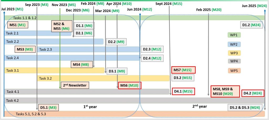
WP 4 is separated in 2 distinctive Tasks, 4.1 and 4.2 (with grey colour in Fig. 2) which will have as outcome 2 respective Deliverables, D4.1 and D4.2. This WP is also linked with 3 Milestones MS6, MS7 & MS8 (all with red colour in Fig. 2).
Task 4.1 Development of a geodatabase for coal heritage sites
For this task, CERTH will collect and homogenize geospatial data and relative texts from the selected coal mines (WP3) in order to process them as input for the web application based on the developed geodatabase. All data will be represented as tables in EXCEL format and as shape files / feature classes (ESRI Standard) in a specific coordinate reference system such as ETRS89 – European Terrestrial Reference System.
Task 4.2 CoalHeritage European Visual Map Journal
This task involves the development of a Geographic Information System (GIS) application using interactive – storytelling maps focusing on the coal mines heritage consisting of narrative texts and spatial content. Throughout the project, the database will be constantly updated. CERTH will apply GIS and innovative techniques to develop visual maps with variable and valuable complex datasets related to the identified coal sites. The created digital maps will contain not only multimedia presentations (by using different map layers, photos, videos, diagrams, sound, and music), but also innovative interactive maps composed of multimedia content and informational text about the selected areas.